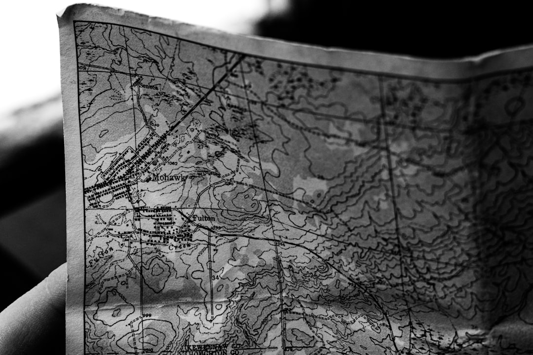
You likely remember them, or at least have seen them languishing in dusty glove compartments or tucked away in forgotten drawers: the paper maps of the 1980s. If you lived through that decade, you certainly wrestled with them. The glossy sheen, the impossibly complex folds, the sheer bulk of them – they represented your primary, and often only, interface with the unfolding world outside your immediate vicinity. And oh, what a struggle it often was. Forget the seamless, intuitive navigation of GPS devices; your journey through the 1980s was a deeply tactile, often infuriating, negotiation with paper.
The Ubiquitous Road Atlas: A Staple of Every Journey
Every car in the 1980s, it seemed, had one. The official state road atlases, the AAA TripTiks, various commercial offerings – they were the bedrock of travel planning. You couldn’t just punch a destination into a device and be guided. No, you had to commit. You had to strategize. This wasn’t a passive experience; it was an active engagement with cartography, a preliminary act of faith that the lines on the page would accurately reflect the reality of the asphalt beneath your tires.
The Pre-Trip Ritual: More Than Just Flipping Pages
Long before you even thought about starting the engine, a significant portion of your travel time was dedicated to map study. This wasn’t a casual glance; it was an immersion. You’d spread the atlas across the dining room table, or perhaps the hood of the car, a sprawling, multi-paneled beast that demanded space and attention. You’d trace your intended route with your finger, carefully noting each highway number, each town name, each geographical marker.
Identifying Major Arteries vs. Local Byways
Your first strategic decision was always the main drag. Did you opt for the seemingly faster interstate highways, with their promise of covering vast distances with relative efficiency? Or did you crave the scenic route, the slower, more characterful experience of county roads and state highways? This choice was dictated not just by time constraints, but by your tolerance for uncertainty. Interstates were predictable, but often sterile. Local roads offered the possibility of discovery but also the very real risk of getting irrevocably lost.
Estimating Times and Distances: A Guessing Game
With the route loosely defined, came the monumental task of estimating your arrival time. Unlike today, where your navigation app offers real-time traffic updates and predicts arrival with uncanny accuracy, then, you were left to your own devices. You’d consult the mileage markers printed on the map and then, using a mental clock or perhaps a pocket calculator, attempt to gauge how long each leg of your journey would take. This calculation was fraught with peril, a blend of optimistic projection and an inherent underestimation of fuel stops, bathroom breaks, and the inevitable road construction delays that seemed to plague every major highway.
The AAA TripTik: A Customized, Yet Still Cumbersome, Guide
For those who opted for a more structured approach, the AAA TripTik was the pinnacle of pre-digital travel planning. These personalized booklets, painstakingly assembled by AAA representatives, provided turn-by-turn directions. They were a step up from a general atlas, offering a more tailored experience. However, they were far from perfect.
The Art of the Fold: Maintaining Legibility
The TripTik, like its atlas counterparts, was a masterclass in folding technology. Getting it open to the correct page, then keeping it open while you were driving, was a skill in itself. The pages would inevitably try to fold back in on themselves, obscuring crucial information just when you needed it most. Employing a strategically placed rock, a heavy textbook, or even a determined passenger to hold it open became routine.
The Redundant Instructions: A Constant Source of Annoyance
While the TripTik aimed to be helpful, it often devolved into a bewildering stream of redundant instructions. “Turn right at Main Street, which is also Highway 50, also known as Oak Avenue.” This level of specificity could be overwhelming, especially in dense urban areas where multiple roads converged or had confusingly similar names. You found yourself constantly cross-referencing, trying to decipher which name or number was the one you were supposed to be looking for.
In the 1980s, navigating with paper maps presented a unique set of challenges, from deciphering complex road networks to dealing with outdated information. Many travelers found themselves lost or frustrated, highlighting the need for more reliable navigation tools. For a deeper understanding of the struggles faced by those who relied on paper maps during this era, you can read a related article that explores these difficulties and the eventual transition to digital navigation systems. Check it out here: Navigating the Past: The Challenges of Paper Maps in the 1980s.
The Act of Navigation: A Physical, Demanding Task
Once you were on the road, the paper map transitioned from a planning tool to an active participant in your journey. It wasn’t something you could simply glance at; it demanded your full attention, and often the attention of your co-pilot.
The Passenger as Navigator: A Demanding Role
The passenger seat was the undisputed domain of the navigator. This was a role that required patience, keen eyesight, and the ability to remain calm under pressure. You were the human GPS, the one responsible for keeping the driver on track.
Spotting Landmarks and Street Signs: A Constant Vigilance
Your primary duty was to be constantly scanning the horizon for the next crucial turn or landmark. The names of towns, the numbers of highways, the specific street signs – these were your bread and butter. You had to be able to read them quickly, process the information, and relay it to the driver in a timely and unambiguous manner. This was particularly challenging at high speeds or in crowded areas where signs could be obscured by trucks, trees, or building facades.
The “Are We There Yet?” Question: Amplified by Uncertainty
The classic question of a child on a road trip was amplified by the inherent uncertainty of paper map navigation. Without a real-time ETA, the answer was always a vague approximation. “We should be there in another hour or so.” “It depends on traffic.” This ambiguity only fueled the “Are we there yet?” chorus, making long journeys even more tedious for everyone involved.
The Driver’s Struggle: Multitasking at Its Finest (or Worst)
For the driver, the paper map presented an even greater challenge. The need to keep their eyes on the road was paramount, but so was understanding the next maneuver. This led to a precarious form of multitasking.
Quick Glances and Trusting Instincts
You’d steal quick glances at the map, trying to absorb information in fractions of a second before returning your gaze to the asphalt. Sometimes, you’d have to trust your instincts, relying on the general direction you were heading and hoping for the best. This could lead to the dreaded moment of realization: you missed your turn.
The Frustration of Missed Exits: A Common Occurrence
Missed exits were a rite of passage for any 1980s driver. The sigh of exasperation, the frantic search for the next turnaround, the added miles and lost time – it was a familiar and deeply irritating experience. You’d swear the exit sign was deliberately hidden or that the map was somehow out of sync with reality.
Unfolding the Labyrinth: The Physicality of Map Manipulation
The very act of interacting with a paper map was a physical endeavor, a wrestling match with a stubbornly folded document.
The Art of the Fold: A Skill Lost to the Digital Age
The complex creasing and folding of a detailed road map was an art form in itself. Achieving the perfect fold, one that exposed the relevant section without obscuring others, was a skill honed through painful trial and error. Conversely, the unfolding was often a chaotic event, a sudden explosion of paper that threatened to engulf the entire interior of the car.
The “Accidental” Fold: Leading to Disorientation
Inevitably, you’d fold the map incorrectly, creating a new and mysterious configuration that bore little resemblance to its original layout. Suddenly, the road you were on seemed to have vanished, or an entirely new highway had appeared where none existed before. This accidental fold could send you into a spiral of disorientation, forcing you to stop and meticulously refold the entire thing.
The Torn Page: A Moment of Panic
The flimsy paper, subjected to repeated folding and unfolding, was prone to tearing. A ripped page, especially if it contained a crucial section of your route, could be devastating. You’d hold the tattered edges together, trying to decipher the remaining lines, a knot of anxiety tightening in your stomach.
The “Crinkled Corner” Phenomenon: A Sign of Wear and Tear
As you accumulated miles and handled the map countless times, its pristine condition would degrade. Corners would become soft and tattered, pages would develop creases that refused to lie flat, and the entire thing would take on a weary, lived-in appearance. This was a testament to its use, but also a visual representation of the struggle.
The Quest for Information: Beyond the Basic Route
Paper maps weren’t just about getting from point A to point B. They also served as a source of information about the places you were passing through, though accessing that information was often a secondary, and sometimes frustrating, endeavor.
Geographical Details: A Static Snapshot
Most maps provided basic geographical details – rivers, lakes, mountains, state boundaries. This offered a static snapshot of the physical landscape. However, these details were often simplified, lacking the nuances of topographical maps or the more granular information you might seek today.
Understanding Terrain: A Limited Perspective
While you could see the general shape of mountains or the presence of a large body of water, understanding the actual terrain and its implications for driving was limited. You couldn’t easily assess gradients or anticipate potential weather impacts based on elevation from a standard road map.
Identifying Points of Interest: A Hit-or-Miss Affair
Many maps included symbols for points of interest – parks, historical sites, even restaurants. However, the selection of these points was often arbitrary, and their location relative to your route could be misleading. You’d often reach a town and realize that the “attraction” marked on the map was miles out of the way or no longer existed.
Road Conditions and Closures: A Constant Unknown
Perhaps the most maddening aspect of 1980s paper map navigation was the lack of real-time information about road conditions. A highway closure due to construction, an accident, or even severe weather could completely derail your meticulously planned route.
The Surprise Detour: The Bane of Every Traveler
You’d drive for hours, confidently following your map, only to be met with a hastily erected “Road Closed” sign. The ensuing detour was almost always a descent into a maze of unfamiliar local roads, with no guarantee that the detour would actually lead you back to your intended path. This was where the true frustration of paper maps became most acute.
Relying on Word of Mouth: Inconsistent and Unreliable
In the absence of any official updates, travelers would often rely on word of mouth – stopping at gas stations, asking locals for information. This was notoriously unreliable. Information could be outdated, misunderstood, or simply inaccurate. You’d find yourself questioning every piece of advice, unsure of what to believe.
In the 1980s, navigating unfamiliar territories often meant grappling with the complexities of paper maps, which could be both a challenge and an adventure. Drivers would frequently find themselves unfolding large, creased maps while trying to maintain focus on the road, leading to moments of frustration and confusion. This struggle is vividly captured in a related article that explores the evolution of navigation technology and the transition from paper to digital maps. For those interested in understanding this shift, you can read more about it in this insightful piece here.
The Dawn of Digital Cartography: A Welcome Relief
It’s easy to romanticize the past, but the era of paper maps was, for many, a constant test of patience. The advent of digital navigation, first with CD-ROM-based systems and then the ubiquitous smartphones we carry today, brought an almost unimaginable level of convenience and accuracy.
The Freedom from Folding: A Small Miracle
The simple act of not having to wrestle with a creased and stubborn piece of paper was a profound relief. The ability to zoom in and out, to re-route on the fly, to have directions spoken to you clearly – these were revolutionary changes.
Real-Time Updates: A Game Changer
The ability to see traffic conditions, road closures, and even the speed of your journey displayed in real-time transformed the driving experience. No longer were you blindsided by unexpected delays. You could make informed decisions and adjust your route accordingly.
The End of the “Are We There Yet?” Era (Sort Of)
While the question might still arise from restless passengers, the navigator no longer felt the weight of complete uncertainty. With a constantly updated ETA, there was a tangible sense of progress. The journey, while still potentially long, felt more controllable, less like a blind leap of faith.
The Historical Artifact: A Reminder of a Bygone Era
Today, those old paper maps serve as curious historical artifacts. They are a poignant reminder of a time when travel required more planning, more patience, and a greater acceptance of the unexpected. They represent a challenge that you, the traveler of the 1980s, navigated with varying degrees of success and a significant amount of frustration. The glossy sheen has faded, the creases are permanent, but the memory of that struggle – the unfolding, the squinting, the wrong turns – remains a vivid part of your personal history of navigating the world before digital certainty.
FAQs
1. What were the main challenges of using paper maps in the 1980s?
Using paper maps in the 1980s presented several challenges, including difficulty in finding specific locations, limited information on the maps, and the inconvenience of having to fold and unfold large maps while driving.
2. How accurate were paper maps in the 1980s?
Paper maps in the 1980s were generally accurate, but they often lacked real-time updates and detailed information about specific areas. This could lead to difficulties in navigating unfamiliar locations.
3. What were the alternatives to paper maps in the 1980s?
In the 1980s, alternatives to paper maps included asking for directions from locals, using physical landmarks as guides, and relying on printed travel guides or atlases. Some drivers also used early GPS systems, although these were not as advanced as modern GPS technology.
4. How did the use of paper maps impact travel in the 1980s?
The use of paper maps in the 1980s often led to longer travel times, increased frustration, and occasional wrong turns. However, it also required travelers to be more attentive to their surroundings and develop better navigational skills.
5. What advancements in technology eventually replaced the use of paper maps?
Advancements in technology, such as the development of GPS navigation systems and digital mapping applications, eventually replaced the use of paper maps for navigation. These technologies provided real-time updates, detailed information, and turn-by-turn directions, making them more convenient and accurate for travelers.